
- Products
- Catalogs
- News & Trends
- Exhibitions
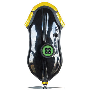
Surveillance camera multiSPEC 4Cfor crops
Add to favorites
Compare this product
Characteristics
- Function
- surveillance
- Application
- for crops
Description
~10 view-points of the same spot to improve accuracy
The fast scoring system enables to acquire several view-points for each spot in the field
Correction of reflectance signal for absolute precision
The integrated lux meter measures light intensity and colour.
The sensor also records the geoposition and date of every picture. This enables to correct the reflected light with the angle of sun’s rays.
Wide angle lens
Enables high speed mapping thanks to large overlap
Typical ground resolution: 5 - 15 cm/px
Images resolution depends on the flight altitude, which can be adjusted depending on the result requirements. For instance: 165 ft flight => 5 cm/px image and 500 ft flight => 15 cm/px image
Images saved in SD card
10 bits raw images in TIFF format
Global shutter
Provides clear, undistorted images even in windy conditions
Related Searches
*Prices are pre-tax. They exclude delivery charges and customs duties and do not include additional charges for installation or activation options. Prices are indicative only and may vary by country, with changes to the cost of raw materials and exchange rates.

