
- Products
- Catalogs
- News & Trends
- Exhibitions
Auto-guided guidance system GPScamera-based

Add to favorites
Compare this product
Characteristics
- Type
- auto-guided
- Network
- GPS
- Other characteristics
- camera-based
Description
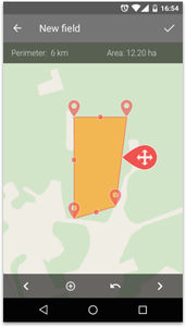
eFarmer navigation application is a GPS guidance system to be used on your Android smartphone and/or tablet. Checking the display while driving will enable you to perform field operations in parallel and evenly spaced lines. Thus to reduce overlaps and missed spots. In our system you are able to have the following navigation patterns:
- Straight АВ is suitable for the regular shaped square or rectangular fields, without “non operational spots”. In this case our system will automatically draw parallel straight lines that you should follow on your field.
- АВ curve is suitable for all field’s shapes and particularly for fields with “non operational spots”. In this case you will make the first run along a curved/non-straight line, after the first turn the application will create next lines parallel to the first run.
- Head Land is suitable for spraying operations. In this case you will make the first run along a contour of the field, set A and B points on one side, after driving around field the application will calculate all lines for field and will calculate remaining area.
VIDEO
*Prices are pre-tax. They exclude delivery charges and customs duties and do not include additional charges for installation or activation options. Prices are indicative only and may vary by country, with changes to the cost of raw materials and exchange rates.

