- Farm Management
- Measuring instrument
- Laser range finder
- Haglöf Sweden AB
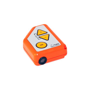
Laser range finder GEO
Add to favorites
Compare this product
Characteristics
- Type
- laser
Description
High-precision laser rangefinder with built-in GPS and compass
The Laser Geo instrument is a high-precision laser rangefinder with built-in GPS, compass, Bluetooth and USB 2.0 for communication. Extreme precision, extreme utility!
-The Laser Geo features long range measurement with high precision laser and integrated tilt- and compass sensors for accurate 3D measurements.
-Results are presented in an integrated heads-up display and external, graphic display køb cialis.
-Built in GPS-receiver and a 5-position numeric ID-attribute allow you to tag important data with coordinates with a simple key press.
-Your data is stored on a built in SSD drive and immediately available for further processing when connecting a standard USB 2.0 interface to any PC or Apple computer. No installation routines, converting software or special drivers are needed.
Your field data can be opened straight in your favorite GIS- or spreadsheet application. Complex operations such as area measurement, 3D mapping of targets and Trail mapping have integrated functions that also are available to you without any external tools.
-The 3D Vector function allows you to measure horizontal targets such as canopy width.
-3-point, 2-point or 1-point or direct height measuring - choose preferred method to work with in the easy-to-follow menu system.
-A non-magnification dot sight helps you to identify individual targets such as tree tops and power lines.
-New functions can be implemented and alternative firmware’s for user specified utilization standard applications can be offered to you. Contact us for details and offer!
Catalogs
The Laser Geo
2 Pages
Vertex Laser Geo
2 Pages
*Prices are pre-tax. They exclude delivery charges and customs duties and do not include additional charges for installation or activation options. Prices are indicative only and may vary by country, with changes to the cost of raw materials and exchange rates.


