Monitoring software eMotion 2data managementmappingagricultural

Add to favorites
Compare this product
Characteristics
- Function
- monitoring, data management, mapping
- Applications
- agricultural, precision agriculture
Description
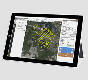
eMotion is senseFly’s intuitive ground station software, supplied with every senseFly drone. Use it to plan, simulate, monitor and control your mapping flight.
Import your background map of choice and draw a rectangle (or create a more complex polygon) over the area you want to map. Then define your required ground resolution and image overlap. eMotion will automatically generate a full flight plan, calculating the eBee’s required altitude and displaying its projected trajectory.
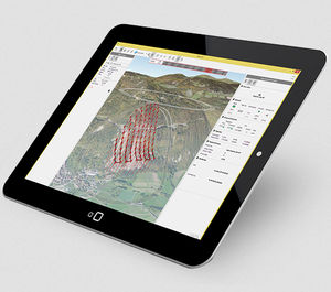
Flying over uneven terrain? Use eMotion's 3D mission planning feature to consider elevation data when setting the altitude of mission waypoints and the resulting flight lines - improving ground resolution and increasing mission safety. You can even check your flight plan in Google Earth, using eMotion's built-in interface.
eMotion's Simulator mode will help you plan your flight and explore the advanced functions of your senseFly drone.
Simulating your flight helps you understand the position and size of images that will be taken. It also allows you to learn more about advanced functions, such as in-flight waypoint editing and camera control, without putting your drone at risk.
Enter the wind strength and direction, then press Play to 'launch' your drone. You can view all aspects of your flight as the drone flies its mission. You can also use eMotion's Google Earth interface to follow your flight in 3D. Then, if necessary, just update your flight plan and save it for future use.
VIDEO
Catalogs
No catalogs are available for this product.
See all of senseFly‘s catalogs*Prices are pre-tax. They exclude delivery charges and customs duties and do not include additional charges for installation or activation options. Prices are indicative only and may vary by country, with changes to the cost of raw materials and exchange rates.


