- Farm Management
- Measuring instrument
- Towed soil sampler
- STARA S.A. - Indústria de Implementos Agrícolas
Towed soil sampler VERIS CEelectrical conductivity

Add to favorites
Compare this product
Characteristics
- Mobility
- towed
- Technology
- electrical conductivity
- Depth
Min.: 0 cm
(0 in)Max.: 90 cm
(35 in)
Description
It is a sensor developed to measure soil electrical conductivity. Using this piece of equipment, it is possible to classify the areas according to their physicochemical properties and export them to a map. Once the maps are created, it is possible to collect soil samples easier and smartly.
GENERAL FEATURES
CENTRAL UNIT
It provides and receives information. In addition, it communicates with Topper 4500.
OPERATION
The energy supply from the sensing disks to the cable is performed by a central pin installed on the axle.
TOPPER CONTROLLER
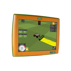
Veris uses the Topper 4500 controller to create electrical conductivity mapping exported in shapefile format to be used in several software programs. Topper 4500 also works as DGPS and georeferences the area, ensuring the reliability of the data collected and the definition of management zones.
SENSING DISKS
Sensing disks 2 and 5 supply the energy. Sensing disks 1 and 6 are the receivers, and they read the depth from 0 to 90 cm. Sensing disks 3 and 4 are the receivers, and they read the depth from 0 to 30 cm.
CORRELATION OF ELECTRICAL CONDUCTIVITY
The use of soil electrical conductivity is an important tool for decision-making when applying Precision Agriculture. The information provided by Veris is correlated with factors that interfere with productivity, among them soil texture and its physical-chemical properties. Thereby, Veris becomes a great alternative to create management zones for soil analysis.
VIDEO
Catalogs
No catalogs are available for this product.
See all of STARA S.A. - Indústria de Implementos Agrícolas‘s catalogsOther STARA S.A. - Indústria de Implementos Agrícolas products
PRECISION AGRICULTURE
*Prices are pre-tax. They exclude delivery charges and customs duties and do not include additional charges for installation or activation options. Prices are indicative only and may vary by country, with changes to the cost of raw materials and exchange rates.


