
- Products
- Catalogs
- News & Trends
- Exhibitions
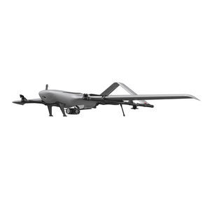
Rotary wing agricultural drone M500quadrotoraerial photographymapping

Add to favorites
Compare this product
Characteristics
- Type
- rotary wing
- Number of rotors
- quadrotor
- Applications
- precision agriculture, aerial photography, mapping, for spraying
Description
XAG M500 Remote Sensing Drone is designed for precision agriculture, with the capability to fly autonomously and capture high definition images with high-performance data processing. Partnering with XAG M500, you can better understand your farm to enable timely and effective actions.
Map precise
The XAG M500 can help build a digital map of your farmlands, in which each plot and each crop has its own coordinate that allows precise operation of autonomous drones and robots.
Scout effortless
The XAG M500 can fly autonomously at high-frequency to capture overall farmland images.
Without getting their feet on the ground, farmers can master every change of their fields with ease and take timely measures.
Grow smart
By taking advantage of third-party AI software, the XAG M500 can help you gain insight into plant growth and identify crop abnormity. Decisions are made with science to enable variable-
rate spraying and fertilization.
VIDEO
Catalogs
M500 Remote Sensing UAS
28 Pages
Exhibitions
Meet this supplier at the following exhibition(s):

Related Searches
- Guidance system
- Automated guidance system
- Agricultural UAV
- Tractor guidance system
- Agriculture machine guidance system
- Rotary wing agricultural UAV
- Precision agriculture agricultural UAV
- RTK guidance system
- Quadrotor agricultural UAV
- Mapping agricultural drone
- Spraying agricultural drone
- Monitoring agricultural drone
- Fixed-wing agricultural drone
- Bi-rotor agricultural drone
*Prices are pre-tax. They exclude delivery charges and customs duties and do not include additional charges for installation or activation options. Prices are indicative only and may vary by country, with changes to the cost of raw materials and exchange rates.


